The North Pole (1636) - Reliefs Editions
The North Pole (1636)
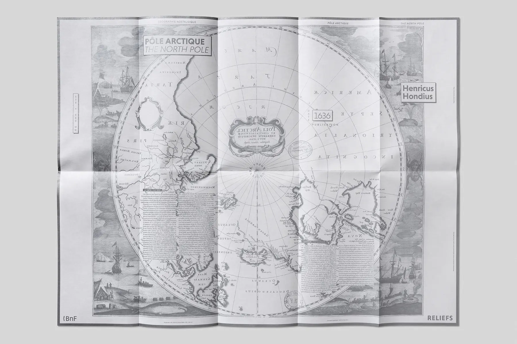
This Dutch map of the North Pole and its surroundings owes much to two great explorers from the turn of the 17th century: to the east, the Dutchman Willem Barentsz (1550–1597), who unsuccessfully sought the Northeast Passage; and to the west, the Englishman William Baffin (1584–1622), who failed to find the Northwest Passage. Cartography of that time, particularly at these latitudes, remained approximate and was filled with vast, uncharted areas. The author, a cartographer of the 'Golden Age' in The Hague, surrounds these blank spaces with evocative illustrations but makes no attempt to conceal them.
- ills colour
- 18 x 33 cm
- map
- French/English
Product Information
Product Information
Shipping & Returns
Shipping & Returns


The North Pole (1636) - Reliefs Editions
The North Pole (1636) - Reliefs Editions
The North Pole (1636)
This Dutch map of the North Pole and its surroundings owes much to two great explorers from the turn of the 17th century: to the east, the Dutchman Willem Barentsz (1550–1597), who unsuccessfully sought the Northeast Passage; and to the west, the Englishman William Baffin (1584–1622), who failed to find the Northwest Passage. Cartography of that time, particularly at these latitudes, remained approximate and was filled with vast, uncharted areas. The author, a cartographer of the 'Golden Age' in The Hague, surrounds these blank spaces with evocative illustrations but makes no attempt to conceal them.
- ills colour
- 18 x 33 cm
- map
- French/English
Original: $28.59
-65%$28.59
$10.01Product Information
Product Information
Shipping & Returns
Shipping & Returns
Description
The North Pole (1636)
This Dutch map of the North Pole and its surroundings owes much to two great explorers from the turn of the 17th century: to the east, the Dutchman Willem Barentsz (1550–1597), who unsuccessfully sought the Northeast Passage; and to the west, the Englishman William Baffin (1584–1622), who failed to find the Northwest Passage. Cartography of that time, particularly at these latitudes, remained approximate and was filled with vast, uncharted areas. The author, a cartographer of the 'Golden Age' in The Hague, surrounds these blank spaces with evocative illustrations but makes no attempt to conceal them.
- ills colour
- 18 x 33 cm
- map
- French/English